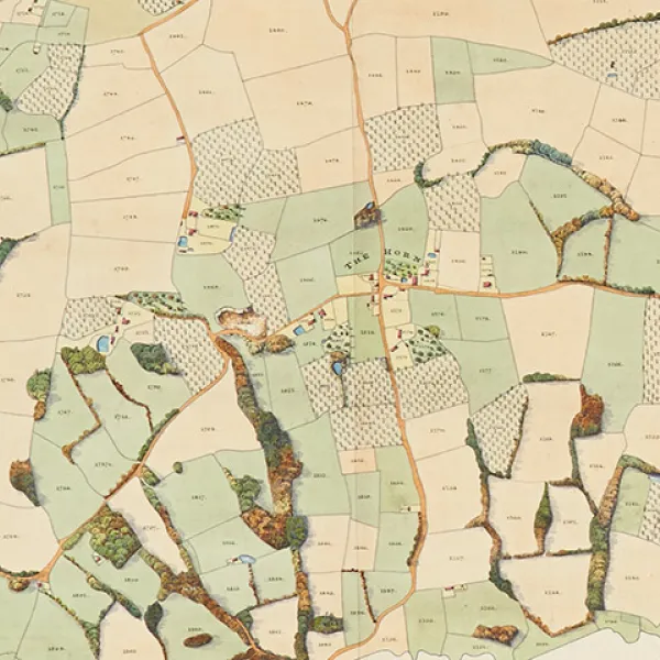
The map collection located in Christ Church Library and Archives is probably among the least known in Oxford.
It includes such treasures as Martin Llewellyn's 1598 Atlas of the East (a volume unknown to map historians for over three and a half centuries, it constitutes the earliest sea atlas by an Englishman), the 1612 Plan of the site of the Castle, showing Sellion’s House, the Jews’ Mount, houses in Castle Ditch and the West Gate of the City, Frederick Young's 1818 Plan of the Parish of Hawkhurst in the County of Kent (a masterpiece of cartographic art which also serves a practical role as a graphic inventory of land use) and Benjamin Badcock's 1829 Plan of estates in the University, City and Suburbs of Oxford belonging to Christ Church.
Hawkhurst 1818 - Plan of the Parish of Hawkhurst in the County of Kent
Young, Frederick [cartographer]
Shelfmark: Archives Maps Hawkhurst 2
A masterpiece of cartographic art which also serves a practical role as a graphic inventory of land use. Unfortunately, the written survey which should accompany the map no longer survives.
Martin Llewellyn's Atlas of the East (1598)
Shelfmark: MS 709
Atlas of sixteen manuscript charts on vellum showing the route to and from the East Indies attributed to Martin Llewellyn, Steward of St Bartholomew's Hospital, London from 1599 to 1634, apparently from observations on a voyage that he may have made with Cornelis de Houtman in 1595–1597. The charts cover the Cape of Good Hope to the Far East, including Japan, the Philippines, New Guinea and the Mariana Islands.
The atlas was presented to Christ Church Library by Llewellyn's sons in 1634, with the note that the charts were “drawn in his own hand and according to his own observations.”
Oxford, Cowley 1777 - A Survey of an Estate, Belonging to the Dean and Canons of Christ Church, lying in the Parish of Cowley
Chapman, W. [cartographer]
Shelfmark: Archives Maps Cowley 1
Oxford, St Thomas 1780 - A Plan of St Thomas Parish, Oxford
Shelfmark: Archives Maps Oxford (St Thomas) 4

